After six months on the road, we need a break from travelling and a break from the caravan. A kitchen that remains in one place and doesn’t require daily setup. Cooking without wind and rain. No more emptying of toilet cassettes. A break from hitching and unhitching and pushing up roofs and packing away everything when moving to a new site.
We are now in the countryside of the southwest corner of WA waiting for the Easter school holidays to pass (it’s the usual story: everything on the coast is booked out). Soon we will be moving closer to the larger Perth metropolitan area and join civilisation again.
It’s been an unforgettable journey. We’re so glad that we overcame our initial trepidation (being newbies at caravanning) and jumped into the river of life. It was one of the best decisions we’ve made.
Thank you for reading this blog. One day we will be travelling again and happily write new chapters to this blog.
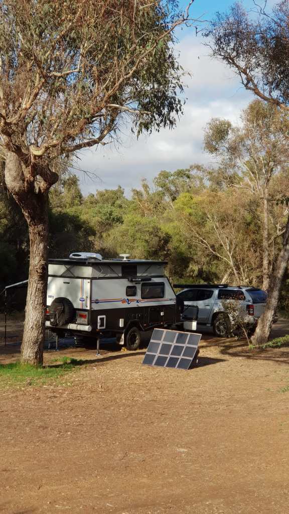
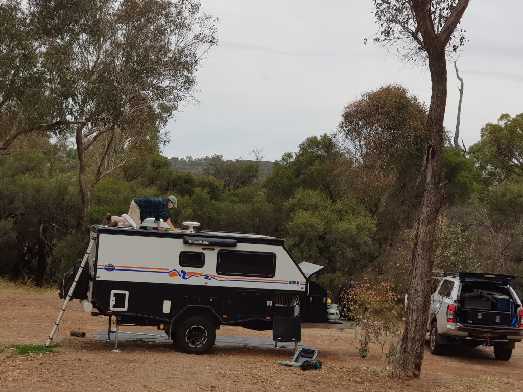
Here are some pictures of us and our beloved caravan:
Just when we thought that we had about seen enough of Australian national parks, we stumbled across one that neither of us knew and it took our breath away. Really, it was by accident that we found it at all. Trying to reduce daily travelling times, we had booked a campsite a bit inland from Hopetoun, our next stop after Esperance.
In contrast to Esperance where we stayed in a fully booked caravan park (which was like living in a beehive), now we were on a remote farm tucked into bushland – all by ourselves. Our host, Kim, told us about Fitzgerald River National Park near by. A UNESCO world heritage biosphere. 3000 square kilometer of untouched nature with a rugged coastline, and a wonderland of rare plants and species. Well, we were there, so why not have a look at it?
If we had known what a treasure trove Fitzgerald River NP was, we would have stayed longer. All we had was a 2-hour window on a Saturday morning courtesy of the weather. So we took the closest road in and it was Hamersley Drive a few kilometres north of Hopetoun.
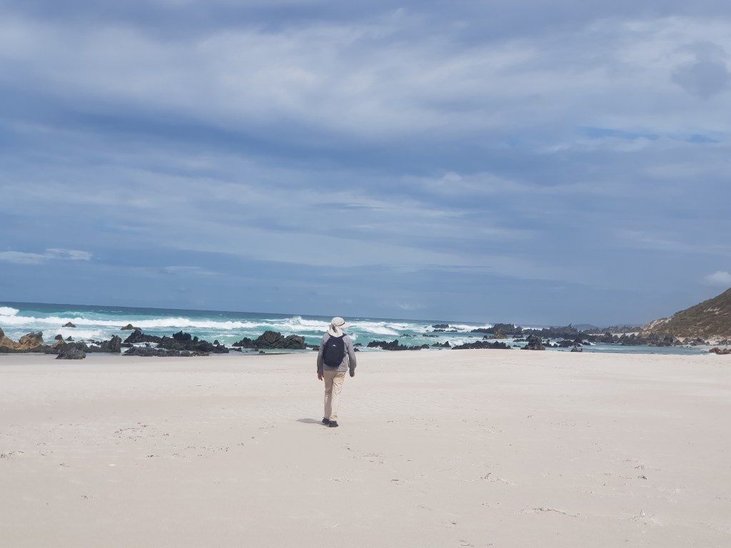
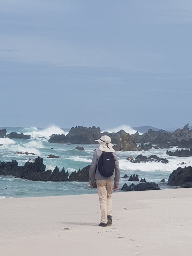
Solitude. To capture the scale and silence of the sweeping landscape is impossible. We walked the Hakea trail from the carpark at the end of Hamersley Drive (that’s the entry point from the east) down to the inlet and across the sand bank to the ocean. And we were the only people on the track. No footprints before us.
Walking to the edge of the water, we were surprised by the stark beauty of the place: dragon scales hidden in the foam of the waves – wild, unadulterated nature on its own terms.
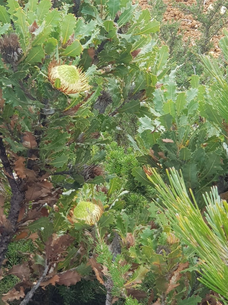
On the way back we stopped at a lookout that was further inland. When you gaze across the landscape to take in the big picture, the incredible diversity of plants might elude you. While resting, my vision opened and I started seeing it.
Even at this roadside stop, the variety of plants was astonishing. It was autumn and there were still a lot of flowering plants and shrubs. The pictures above show just two of them. If you want to get an idea what the park is like in spring, have a look at this photography blog. I’m already planning our next visit to the area.
Mud-soaked and weary, we arrived at Norseman where we stayed for a couple of nights at the free RV park. It rained most of the time and cleaning our dirty gear had to wait until Esperance.
Everything in Esperance was booked out. Mike (the hero) gave it another try and scored the last remaining place in a caravan park. Later on, he succeeded in extending our stay from two to four days by switching sites. We expected a lousy site, possibly next to a road or opposite the garbage… but life gave us this:
Yes, that turquoise strip is the Indian Ocean. And walking along the bay looked like this:
We had busy and glorious days at Esperance. The bay is actually an archipelago similar to what I’ve seen in Stockholm – lots of small and larger rock islands. It is very beautiful and aptly named the Bay of Isles (or Recherche Archipelago).
Our first overnight stop was at the Border Village Caravan Park only meters the from intimidating WA quarantine & biosecurity checkpoint. Overworked staff; stressed out truckies; crazy crows. The road leading up to the border had lots of garbage strewn both sides. But once we were settled in our site, we were surrounded by friendly fellow nomads and all was good. You could take 10-min hot showers for a $2 coin. Luxury!
Next morning it was drizzling and we drove into WA after a minimal quarantine inspection. Everything looked a lot cleaner on the other side: well-kept rest stops with big yellow trashbins and signs against littering. Something funny happens with time, though: The 1.5 hour time difference is reduced to 45 minutes. It’s a 150 km long mini time zone called Central Western Time (CWT).
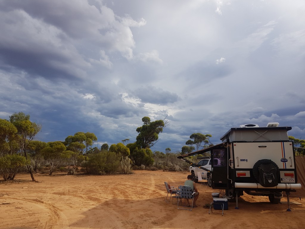
It is an epic drive over the endless plain – sometimes monotonous, sometimes mindblowing with tantalising views across the wilderness, cliffs, and ocean. Between Caiguna and Balladonia, the road is an unbroken straight line for 140 km. Our second overnight stop was on a free RV bush camping rest area close to the end of this stretch.
A handful of other rigs was already parked there. Lots of space, red dirt, fragrant gumtrees (yes, there were trees – maybe the end of the Nullarbor). No internet and no phone connection. 34 degrees.
We can’t say we didn’t see it coming. All too familiar cloud formations (for Queenslanders like us) gathered on the horizon. We were in the middle of collecting our things when the storm hit. The wind blasted us with dust and almost tore off the awning. We hung on to it for dear life. Then a sudden gap – and we managed to pack it away. Seconds before the rain started pelting. And then the dust turned into mud… and became a mud slide. The storm continued into the night with full force, thunder and lightning.
The morning after was peaceful and very, very muddy. Everything left outside was covered in it: shoes, chairs, buckets. The kitchen was a mess. We had bags full of rags and clothes soaked in it. A lot of dust had gotten inside the Scout as well. There was no escaping. We drove on to Norseman.
A 1200-km road through the semi-desert across the world’s largest piece of limestone, most of it in a straight line. A large part of the plain is without trees. This is the Nullarbor (Latin: nullus arbor) that connects South and Western Australia. The plain breaks off abruptly in dramatic cliffs into the Southern Ocean. North of it, deserts stretch for thousands of miles. Everything is vast: the plain, the ocean, the sky, and the distance.
We set off from Penong at sunrise. The farther we drove, the wider the horizon seemed to stretch. Signposts for the eyes (trees, buildings, poles) disappear. The sky expands across the plain in translucent blue, limitless.
It’s disorienting and exhilarating. Then the first milestone: Nullarbor Roadhouse. It is a very busy old outback hotel with a huge area for all the trucks, caravans, cars, and everything else that passes through. The photo below shows the western part of this area and our Scout-14 is the first vehicle on the left.
People stumble out of their cars (or whatever they are driving), gaze at the scenery, gas up, drink coffee, look at the photos of snakes currently active around the hotel, or take selfies in front of the big sign.
We drove on to Border Village just before the WA border to spend the night there and eat our remaining fruit and vegetables. The biosecurity regulations for entering WA are very strict.
Once we crossed the border into SA (South Australia), our mood lifted. It was warm, actual summer weather. We loved the wide, open road (no ups and downs, no serpentines) and the vast skies. The red dirt, the smell of the gum trees, the songs of the magpies, and the laughter of the kookaburras.
Taking it day by day, we discovered Coonalpyn with its stunning silo art. It also has a very innovative self-service caravan park right next to a gorgeous outdoor swimming pool. How nice it is to float in water and watch the sunset after a day of driving!
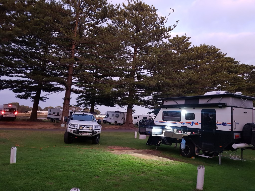
We drove through Murray Bridge and around Adelaide unexpectedly finding ourselves in the Barossa Valley (a famous wine region in SA). Further north we found the lovely Auburn Showgrounds Caravan Park where we spent the weekend.
The Eyre peninsula was next on our itinerary. Everything on the coast was booked out though. We should have known that we were not the only grey nomads avoiding the tropics. A fellow camper told us that last year there were 45,000 new registrations for caravans. All these people need to go somewhere.
We took it as a hint from existence and stayed inland on the direct route with overnight stays at Kimba Roadhouse (owned by an Indian family and famous for its curries) and Penong caravan park (next to old metal windmills used for pumping water). Our next destination was the Nullarbor plain.
To make it easier to say goodbye to Tasmania we booked our first stay on the mainland in Port Fairy. The name says it all – it is a wonderful historic fishing village at the end of the Great Ocean Road in Victoria. I only have photos of the breakfast before we left. Why? The weather kept to the Tasmanian theme. It was cold, rainy, and windy. Here we are in the early morning getting ready to set off into South Australia.
What would we do after Tasmania? The original plan was to do an anti-clockwise lap around Australia going north across the top end into WA (Western Australia) and then tracking down the west coast. Instead, we opted to take the direct route, fast. Several factors contributed to this decision: A cyclone had caused widespread damage to roads and infrastructure in Northern WA. Far North Queensland was affected by severe flooding. And we had exhausted our need for sightseeing in Tasmania. Frankly, we needed a break from travelling. A longer break. We used to live in Fremantle and had friends there.
We’ve been four months in Tasmania and on the 14th of March it was time to leave. Here you can see us lining up for the late-night departure on the Spirit of Tasmania dock at Devonport. (The photo is taken from inside our car looking at the lines in front of us. The ferry is on the left behind the cars.)
It was a long wait until boarding and to pass the time I started making a list of the most notable locations and events during our stay (totally subjective).
Imagine it’s early in the morning, you try to leave your caravan but the wind outside is so strong that you can barely open the door. Yes, we had glorious weather at Stanley. Every other day, though, we had gales, low grey clouds, and intermittent rain. So we spent our time either inside the caravan (and enjoyed ourselves in a confined space) or took the car to the next coffee shop to hang out there (and wondered about our budget).
The next day, however, it was even more glorious. We really fell in love with the place.
One day later, it was gales and clouds again. And a severe weather warning. We thought that this applied to what was happening today. But we were wrong. A cold front was about to hit the entire west coast bringing 60 km winds with gusts up to 110 km. Maybe also a thunderstorm and possibly hail. Temperatures would drop. Then we noticed that quite a lot of rigs were leaving the RV park.
We had already experienced several nights where our caravan was rocking and shaking in the wind. Maybe we could move to a cabin in the local caravan park? Unfortunately, everything was booked out. But we were lucky: The friendly receptionist offered us a wind-protected spot right next to the office building. And there we weathered the storm. The caravan didn’t shake. We listened to the wind and the pounding rain. We ate instant noodles and bananas and muesli bars. And when the skies cleared, we saw a couple of fantastic rainbows.
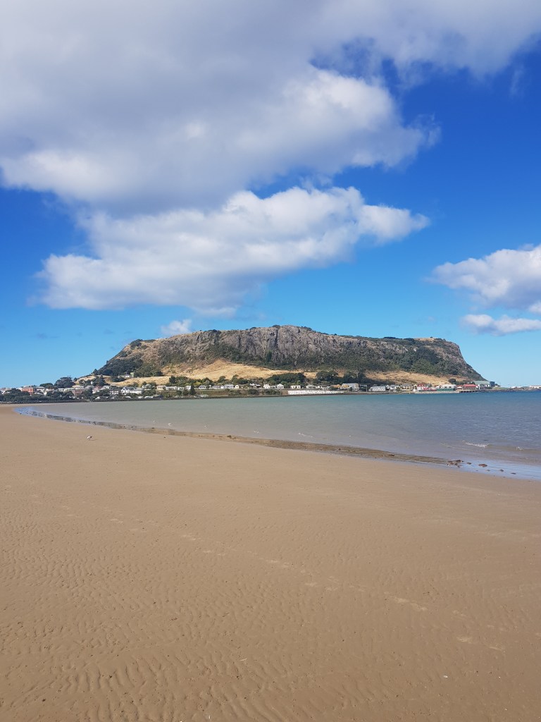
A highlight or trials and tribulations? It was both. Our time in Stanley, a tiny town in the far northwest of Tasmania, was stunning – and stormy. We had glorious weather and severe weather. But first things first. What is the “Nut”? Here is a photo:
This is the view from the beach close to our RV park. From the side it looks like this:
And you can climb on top (or take the chairlift) and look down and try to locate your caravan…
Ours is close to the golf course at the edge of town and close to the beach, in the far distance… All was good but the western edge of Tasmania is also known for its heavy weather and ferocious winds. More about this in part 2.